Runway Prompts for Animated Map Lessons Without Distorting Geography
Animated maps can make migration, exploration, trade, and historical change easier to follow, but generative motion may bend coastlines or relocate borders. This guide shows educators how to use Runway with a verified base map, constrained prompts, separate labels, and a geography-focused review process.
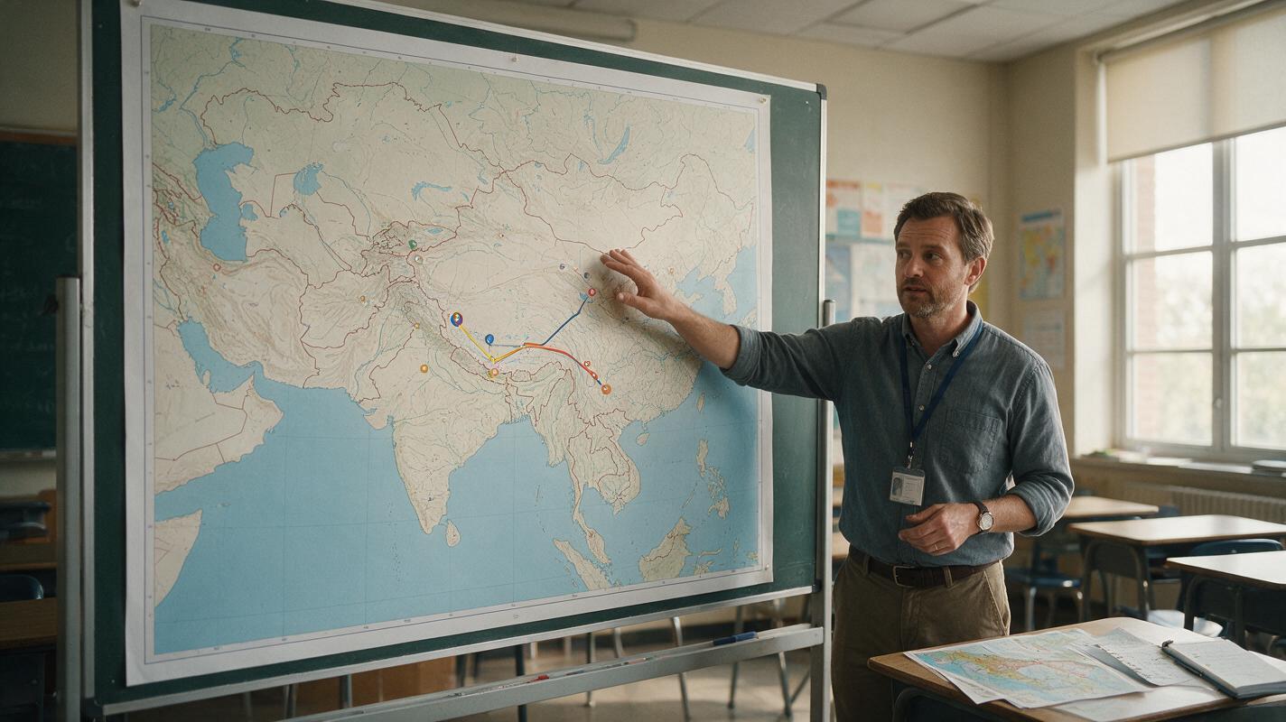
Table of contents
Animate the route, not the geography
When an animated map bends a coastline, moves a border, or sends a route through the wrong region, it stops being a useful lesson visual. The safest Runway workflow is to begin with a verified static map and request motion only for the instructional layer: a route line, marker, highlighted area, or time indicator. Geography, labels, scale, and orientation should remain fixed.
This method works well for migration routes, trade networks, military campaigns, journeys, ecological movement, and simplified transport lessons. It is not a substitute for geographic information system software when exact coordinates or measured spatial analysis are required.
Build a trustworthy base map before adding motion
Start with a map whose boundaries and place names you have already checked against an authoritative source appropriate to the lesson. Confirm that you have permission to use or adapt it. If the subject involves disputed borders, historical territories, or Indigenous lands, choose a source and date deliberately rather than treating one map as politically neutral.
A generation-ready base map should contain only the information learners need:
- Stable geography: clear coastlines, borders, rivers, and landforms relevant to the explanation.
- Visible orientation: a north arrow when orientation is not obvious.
- Useful context: enough neighboring territory to show where movement begins and ends.
- Open space: room for a route, key, or annotation without covering essential features.
- Consistent projection: one projection throughout the sequence, with no simulated globe rotation unless that change is intentional.
Accuracy rule: If a feature must be geographically correct, place it in the approved source image. Do not ask the video model to invent it from prose.
Remove decorative clouds, textured paper, glowing borders, and unnecessary three-dimensional terrain. These elements create more opportunities for the model to interpret a map as a moving landscape rather than a fixed instructional diagram.
Separate factual layers from animated layers
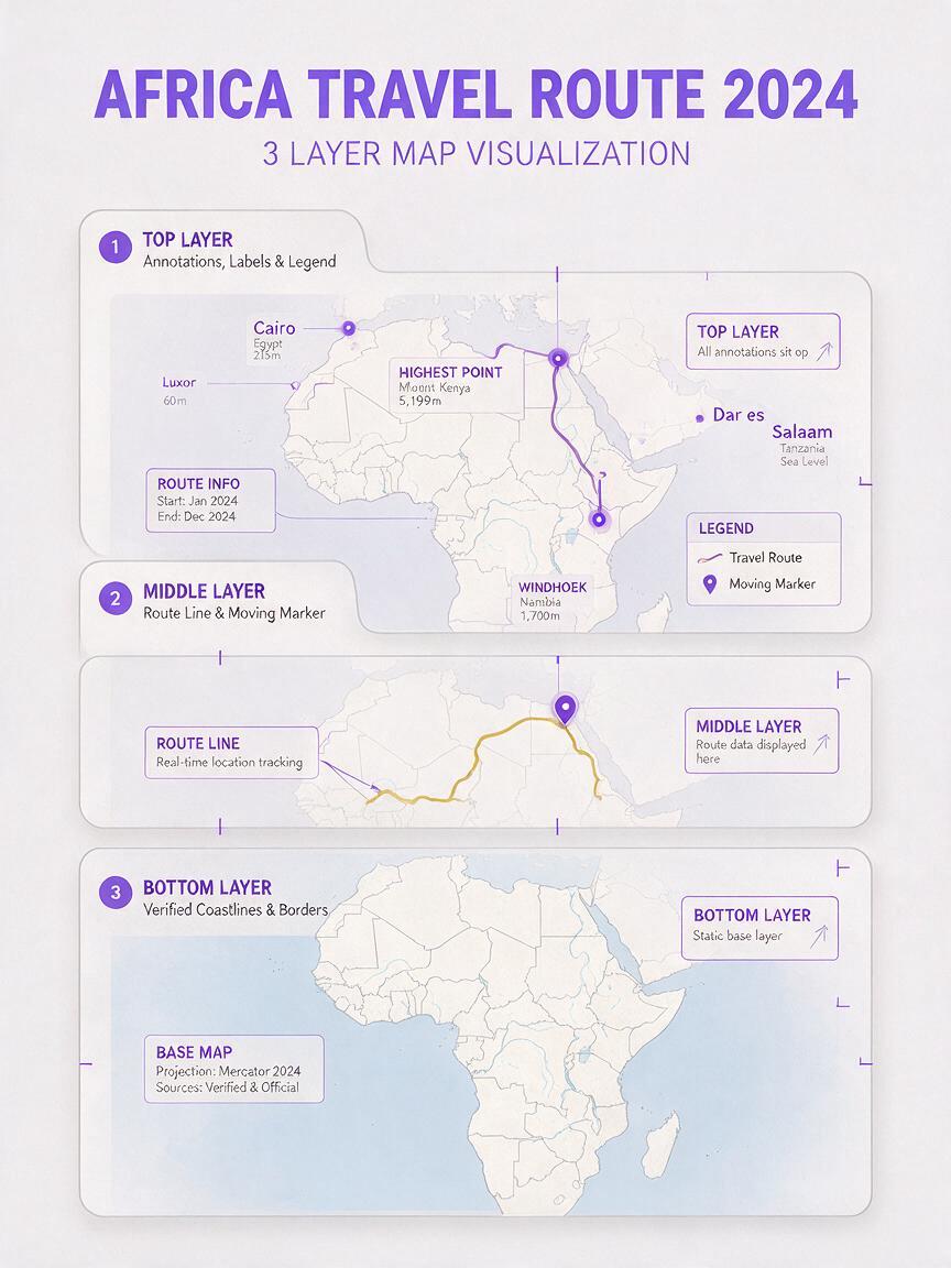
Think of the lesson visual as three layers. The base layer contains the verified geography. The motion layer contains the route or changing emphasis. The editorial layer contains labels, dates, captions, and the legend.
| Layer | Typical content | Recommended treatment |
|---|---|---|
| Base geography | Coastlines, borders, rivers, cities | Keep completely still |
| Instructional motion | Route line, marker, pulse, highlighted region | Animate one change at a time |
| Editorial information | Names, dates, scale, legend, captions | Add or restore in the editor |
This separation reduces ambiguity. It also makes corrections cheaper: a misspelled city name can be fixed in the editor without regenerating the route animation.
For the cleanest result, upload the verified map to an image to video workflow and describe only the movement that should occur. Avoid prompts that ask Runway to redraw, enhance, modernize, or transform the map.
Use prompts that lock the map in place
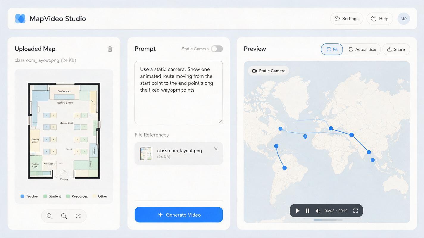
A reliable prompt identifies the visual as a flat educational map, specifies the single moving element, and explicitly protects the factual features. Use a static camera unless movement is essential to the learning objective.
Flat educational map viewed straight on. Preserve the supplied map exactly: identical coastlines, national borders, rivers, city positions, colors, scale, and orientation. Keep the camera completely static. Animate only a thin blue route line drawing smoothly from [START] to [END] through [WAYPOINTS]. No morphing, no zoom, no rotation, no moving labels, no added locations, no terrain transformation. Clear classroom explainer style.Replace the bracketed terms with verified locations. If the route has several turns, use visible waypoints rather than asking the model to infer a historically or geographically correct path.
Prompt for a migration route
Preserve the uploaded map as a motionless background. A single orange route line appears gradually from the northern breeding area to the southern wintering area, following the marked waypoint dots in order. One small bird symbol travels along the line at a steady pace. Keep all land, water, borders, labels, and waypoint positions unchanged. No camera movement and no new map details.Prompt for a trade network
Static classroom map with all geography locked. Reveal the three pre-drawn trade routes one at a time: first green, then blue, then purple. Each route grows from its origin toward its destination. Do not alter ports, coastlines, borders, labels, or map projection. No simulated travel through three-dimensional terrain.Generate a short test before committing to a full sequence. A restrained clip is easier to evaluate and combine with narration than one long animation containing several simultaneous routes.
Match motion to the teaching claim
Animation creates meaning. A continuous moving marker can imply that a journey was direct, uninterrupted, and equally fast throughout. A pulsing region may imply precise boundaries even when the evidence supports only an approximate area. Choose motion that matches what the source material can establish.
- Use a growing line when the lesson emphasizes direction or sequence.
- Use waypoint reveals when intermediate locations are important.
- Use a soft regional highlight when the evidence describes an approximate zone.
- Use separate clips or cuts when movement occurred in distinct phases.
- Use a time counter when elapsed time matters, but add it during editing for dependable text.
Do not use a smoothly traveling icon to claim an exact path unless the route is supported by evidence. For uncertain historical movement, a sequence of dated regions may communicate the evidence more honestly than a precise line.
Keep names, dates, and legends outside the generation
Small text is vulnerable to distortion from frame to frame. Even when the opening frame looks correct, letters can soften, duplicate, or change during motion. Preserve an unlabeled or minimally labeled map for generation, then place essential text over the finished clip in your video editor.
Use large, high-contrast labels and keep them on screen long enough to read. Captions should explain the meaning of the movement rather than merely repeat the narration. A useful caption might say, “The highlighted area is approximate,” or “Route shown as a simplified teaching model.”
For color accessibility, do not rely on hue alone. Give each route a second cue, such as a solid versus dashed line, a distinct marker shape, or a visible route name. Check the final clip at the size learners will actually see in the learning platform.
Fix common Runway map-animation failures
| Failure | Likely cause | Practical correction |
|---|---|---|
| Coastlines wobble | The prompt allows global motion or transformation | Add “preserve the supplied map exactly” and “animate only the route line” |
| Borders drift | Too much camera movement or visual texture | Use a flat map, static camera, and shorter generation |
| The route takes a shortcut | The model is inferring the path | Place visible waypoint dots in the source image |
| Labels mutate | Text is embedded in the generated frames | Remove nonessential labels and restore them in editing |
| The map becomes a globe | Cinematic language suggests three-dimensional motion | Specify “flat educational map viewed straight on” |
| Several routes merge | Too many simultaneous instructions | Generate each route separately and combine the clips |
If a result contains one local error, do not automatically lengthen the prompt. First simplify the requested motion. One route, one direction, one marker, and one fixed camera usually provide a better diagnostic test than a paragraph of competing instructions.
Review the map like instructional content
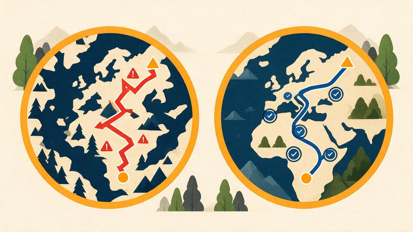
Watch the animation once without narration and pause on the beginning, middle, and final frames. Compare each frame with the approved base map. The route should support the lesson without changing the evidence beneath it.
- Are coastlines, borders, rivers, and city positions unchanged?
- Does the route pass through every required waypoint in the intended order?
- Could the motion imply unsupported speed, certainty, or continuity?
- Are uncertain areas identified as approximate?
- Do captions, narration, and animation make the same claim?
- Can learners distinguish routes without relying on color alone?
- Is the source credited where the lesson or institution requires it?
Ask a subject specialist to review politically sensitive, historically contested, or assessment-critical maps. Generative output should be treated as a draft visual, not as independent geographic evidence.
Final checklist
- Use a verified, licensed base map with the correct date and scope.
- Lock geography, projection, orientation, and camera position.
- Animate only one instructional layer at a time.
- Pre-mark waypoints instead of asking the model to infer a route.
- Add names, dates, captions, scale, and legends during editing.
- Review representative frames against the original map.
- Disclose simplification or uncertainty when it affects interpretation.
When your source map and route are ready, test this prompt yourself with a short clip before building the complete lesson sequence.
Keywords
runway prompts, animated map lessons, educational maps, image to video, geography teaching, history lesson visuals, map animation